
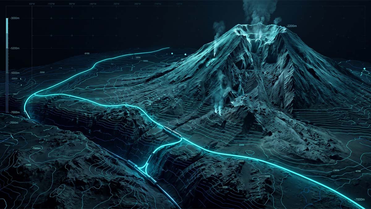
Marine Geohazard Assessment: De-Risking Subsea Infrastructure Against Volcanic Flank Collapses and Deepwater Landslides
A deterministic marine geohazard assessment serves as the indispensable fiduciary barrier protecting multi-million-dollar subsea cable systems and energy export interconnectors from catastrophic seafloor failure along active convergent margins. In deepwater volcanic arcs, failure to quantify the mechanical interaction between magmatic plumbing systems, flank instability, and gravity-driven sediment runout guarantees operational disruption, severe contractual disputes, and unrecoverable capital destruction.
CAPITAL EXPOSURE & CONTRACTUAL VULNERABILITY
The Fiduciary Imperative of Marine Geohazard Assessment: Uncovering Deepwater Geohazards Beyond Contractor Desktop Surveys
Engineering Definition: A marine geohazard assessment is a multi-disciplinary spatial and geotechnical evaluation quantifying seabed stability, seismic triggers, fault shearing, and gravitational mass wasting to mitigate structural asset failure across subsea corridors in accordance with DNV-RP-F107 and ICPC recommendations.
For asset owners, offshore project directors, and sovereign infrastructure lenders, capital deployment in subsea telecommunication cables and power interconnectors frequently encounters a critical vulnerability: the superficial desktop study. Engineering, Procurement, Construction, Installation, and Commissioning (EPCIC) contractors routinely rely on regional, coarse-resolution bathymetric datasets and historical seismicity catalogues. This practice produces an oversimplified appraisal of subsea cable route risk, treating deep abyssal plains as benign depositional basins while failing to identify high-energy mass-wasting conduits generated by adjacent volcanic edifices.
When subsea transmission assets are routed across subduction zones and marginal back-arc basins without an exhaustive marine geohazard assessment, developers bear uncapped financial exposure. The primary commercial threat is rarely limited to immediate physical asset replacement. Instead, it manifests as extended operational downtime and extreme offshore repair logistics. At water depths exceeding 2,000 meters, mobilizing Class 2 Dynamic Positioning (DP2) cable repair vessels entails weeks of transit time and day-rates ranging from $65,000 to over $110,000 per day.
$4.2M – $11.5M USD
Quantified Capital Loss per Deepwater Subsea Cable Severance Event
Aggregated cost benchmark encompasses emergency DP2 repair vessel mobilization (25–45 day operational window), deepwater ROV intervention at depths >2,500 m, commercial Service Level Agreement (SLA) default penalties, and expedited regulatory permitting for emergency route deviations.
Compounding the physical threat, incomplete geohazard characterization exposes asset owners to severe contractual claims under international construction forms. In projects governed by FIDIC Conditions of Contract (such as the Yellow or Silver Books), installation contractors utilize post-award geophysical discoveries to lodge claims under Clause 4.12: Unforeseeable Physical Conditions. If unexpected volcanic talus fields, unmapped fault scarps, or hazardous bathymetric gradients force vessel stand-down or route alterations, contractors can shift the full burden of delay damages and re-survey costs directly back to the project sponsor.
Establishing an independent, empirical marine geohazard assessment prior to tender lock-in eliminates these contractual loopholes. It forces installation contractors to bid against verified seabed parameters, shielding project CapEx and ensuring uninterrupted bankability from financial close through multi-decade operational life cycles.
EMPIRICAL GEOMECHANICS & PETROLOGICAL RECONSTRUCTION
Architectural Geomechanics of Anomalous Arc Edifices: Translating Magmatic Rejuvenation into Submarine Landslides and Turbidity Current Scour
The geodynamic evolution of volcanic arc infrastructure is governed by complex sub-surface mass transport that standard engineering surveys routinely misinterpret. Recent empirical investigations into the Batu Tara stratovolcano (Komba Island, Eastern Sunda Arc) conducted through advanced petrological and thermobarometric modeling demonstrate how internal magmatic architecture directly controls catastrophic slope instability on the deep ocean floor.
Batu Tara presents an extreme morphotectonic configuration: while the subaerial volcanic cone rises only 630 meters above sea level, its structural edifice base plunges to depths exceeding 3,000 meters into the Flores Sea basin. This creates over 3,600 meters of continuous vertical relief with flank gradients ranging from 25 degrees to exceeding 45 degrees. Such steep bathymetric slopes sit on the threshold of structural failure. When assessing deep water geohazards across this corridor, understanding what triggers mechanical detachment requires peering directly into the volcano’s transcrustal feeder system.
Integrated under the technical framework established by Gamma Abdul Jabbar, S.T., deep-crustal petrological constraints reveal that Batu Tara does not operate like typical calc-alkaline arc volcanoes. Instead, it is fed by highly primitive, ultrapotassic, silica-undersaturated phonotephritic magmas. High-resolution electron microprobe analysis (EPMA) and laser ablation ICP-MS mapping of zoned clinopyroxene phenocrysts demonstrate that the volcano’s primary staging reservoir is situated in the middle crust at approximately 300 MPa (~10 km depth, crystallizing at ~1,060°C).
Crucially, the mineral stratigraphy preserves clear evidence of episodic “mafic rejuvenation.” Hotter (~1,105°C), mantle-derived magmas carrying high-Mg# (up to 91) and chromium-rich (Cr > 6,000 ppm) diopside antecrysts repeatedly inject into the mid-crustal chamber. This deep recharge acts as a physical piston. As ascending magma encounters upper-crustal degassing zones manifested by the sudden crystallization of anorthite-rich plagioclase (An49–90) within feeder dykes rapid exsolution of volatile phases induces intense cyclic overpressure.
This internal pressurization has catastrophic consequences for seabed stability. Magma intrusion into the volcanic edifice drives thermal fracturing, hydrothermal pore-fluid overpressurization, and seismic ground deformation. In the rock record, this destabilization is verified by an extensive, amphitheater-shaped lateral collapse scar opening directly to the east, as well as the documented historic crater flank collapse of 1958.
When a subsea volcanic flank fails under the influence of magmatic intrusion and seismic acceleration (PGA > 0.2g), it triggers massive submarine landslides. These mass-wasting events do not remain localized. Upon entering the marine environment, hundreds of millions of cubic meters of poorly consolidated volcaniclastic breccia, tephra, and basaltic blocks disintegrate into hyperpycnal debris flows and high-velocity turbidity currents.
Applying the Financial Consequence Rule to these geomechanical thresholds reveals direct operational perils:
- Flank Slope Angles (>30°) & Excess Pore Pressure (u2): Unconsolidated volcanic aprons subject to pore pressure spikes experience a collapse in shear strength, driving the Factor of Safety (FoS) below 1.05. A subsea cable crossing the foot of such a slope faces total burial under tens of meters of chaotically bedded debris, rendering standard cable grapnels useless and requiring full route abandonment at a remobilization cost exceeding $8.5 million USD.
- Turbidity Current Hydrodynamic Velocity (>15–20 m/s): Debris avalanches transforming into turbulent gravity flows maintain devastating momentum across runout distances exceeding 60–100 kilometers along abyssal bathymetric channels. A fiber-optic cable resting unburied on the seafloor 40 km from the volcanic center will experience extreme drag-induced tensile loading exceeding its ultimate tensile strength (UTS > 200 kN), resulting in clean mechanical rupture and multi-country telecom blackouts.
- Basaltic Scour & Abrasive Hydrothermal Fluids: High-energy turbidity flows strip surface sediments down to the basaltic basement, subjecting unarmored cables to severe mechanical abrasion and thermal shocks. The resulting insulation failure induces optical fiber attenuation and power-feed shunt faults that standard marine repair methods cannot localize without full seabed re-mapping.
A robust marine geohazard assessment models these runout dynamics deterministically, establishing exclusion zones that route linear infrastructure around bathymetric containment channels rather than directly across the discharge path of volcanic collapse scars.
Standard Contractor Desktop Assumptions vs. GEOPROVE Fiduciary Reality
| Investigation Criteria | Standard EPCIC Desktop Practice | GEOPROVE Fiduciary Engineering Protocol |
|---|---|---|
| Volcanic Arc Geohazard Characterization | Relies on regional subaerial eruption catalogues and assumes deepwater abyssal seafloor (>2,500 m) is hydrodynamically stable. | Integrates transcrustal magmatic architecture, historic collapse scar geometry, and hydrothermal alteration mapping to establish quantitative runout hazard envelopes. |
| Submarine Landslide & Slope Stability Modeling | Calculates 2D infinite slope stability based on assumed friction angles without dynamic pore-water or seismic acceleration factors. | Executes 3D pseudostatic and limit-equilibrium slope stability modeling incorporating site-specific PGA attenuation and excess pore pressure generation (u2). |
| Turbidity Current Impact & Runout Dynamics | Assumes sediment flows dissipate within 5-10 km of slope toe; ignores channelized long-range turbidity currents. | Applies multi-phase hydrodynamic modeling (e.g., Bingham plastic / turbidity flow regimes) to trace high-velocity impact forces across 80+ km of basin floor. |
| Contractual Risk Allocation (FIDIC Clause 4.12) | Leaves seabed geomechanics loosely defined; contractor claims variation orders upon encountering unexpected volcanic debris or fault scarps. | Authors a legally defensible Geotechnical Baseline Report (GBR), binding the EPCIC contractor to explicit physical parameters and eliminating differing site condition claims. |
STRATEGIC CAPEX DEFENSE & DISPUTE ELIMINATION
GEOPROVE Fiduciary Advisory Protocol: De-Risking Subsea Cable Route Risk via DNV-RP-F107 CBRA and Defensive GBR Engineering
Operating under the core institutional principle of “The Brain, Not the Barge,” GEOPROVE provides entirely uncompromised technical oversight. Because GEOPROVE owns no offshore survey vessels, trenching spreads, or installation assets, our advisory work is completely free from equipment utilization bias. We do not sell vessel days; we defend the project sponsor’s capital expenditure.
To translate complex volcanic geodynamics into operational risk mitigation, GEOPROVE executes a structured, multi-tier engineering protocol:
- Quantitative Cable Burial Risk Assessment (CBRA): Utilizing international standards DNV-RP-F107 and DNV-ST-0359, we evaluate the interaction between bottom-founded hazards, anchor snagging, fishing activities, and gravitational slope processes. In deepwater sections where cable burial via jetting or ploughing is mechanically unfeasible due to shallow basaltic bedrock, we define targeted micro-rerouting to avoid submarine canyon axes and specify engineered protection such as articulated split-pipe casing or rock-filter mattresses.
- Drafting the Defensive Geotechnical Baseline Report (GBR): In major EPCIC contracts, ambiguity is the contractor’s most profitable asset. GEOPROVE authors robust GBRs that establish contractual baselines for geotechnical properties, boulder fields, slope steepness, and expected seabed debris. Under FIDIC Clause 4.12, if a contractor encounters conditions that fall within the defined baseline parameters, no claim for additional cost or extension of time can legally survive.
- Geodynamic Alignment with Sovereign Clearances: Deepwater infrastructure traversing maritime boundaries demands stringent statutory compliance. In Indonesian territorial waters, our advisory aligns subsea corridor designs with the Ministry of Marine Affairs and Fisheries (KKP) under PP No. 21/2021 and Kepmen-KP No. 14/2021 governing Subsea Pipelines and Cable Corridors (PKKPRL). Furthermore, all bathymetric, magnetic, and side-scan sonar survey specifications are synchronized with the national hydrographic defense standards established by Pushidrosal (Indonesian Navy Hydro-Oceanographic Center).
By integrating cutting-edge volcanological and geomechanical science into a rigorous marine geohazard assessment, GEOPROVE ensures that project owners do not merely install subsea infrastructure, they secure an asset designed to survive the most violent geodynamic environments on Earth.
Technical Guidance & Frequently Asked Questions
How do submarine landslides impact deepwater infrastructure?
What triggers marine geohazards in active volcanic arcs?
EXPERT TECHNICAL CONTRIBUTOR
Gamma Abdul Jabbar, S.T.
Lead Advisor, Disaster Risk, Liquefaction & Seismic Hazard (PSHA) • Department of Geology, Universitas Indonesia (UI)
Specialization: Probabilistic Seismic Hazard Analysis (PSHA), Deepwater Marine Geohazards, Volcanic Architecture & Petrology, and Geotechnical Risk Auditing. The empirical insights and geomechanical frameworks in this advisory publication reflect GEOPROVE’s unwavering commitment to independent fiduciary due diligence and capital preservation for high-consequence maritime assets.
CAPEX DE-RISKING & DUE DILIGENCE // MARINE GEOHAZARD ADVISORY DESK
Secure Your Deepwater Subsea Route Against Catastrophic Geohazards
Prior to locking in your final Route Position List (RPL), executing multi-million-dollar EPCIC installation contracts, or filing statutory marine spatial applications, submit your corridor data to GEOPROVE for an uncompromised, vessel-neutral geohazard audit and defensive GBR formulation.