




Operations Office Bogor Utara, Kota Bogor
Technical Advisory Desk advisory@geoprove.com
Fiduciary Pre-FEED Scoping +62 21 5088 7700
THE GEOSCIENCE-BASED INFRASTRUCTURE RISK EXPERT

Engineering Ground-Risk Certainty for
Critical Infrastructure.

Independent geotechnical engineering, mine hydrogeology, and site hazard advisory protecting capital-intensive projects across land, mining, and marine infrastructure.

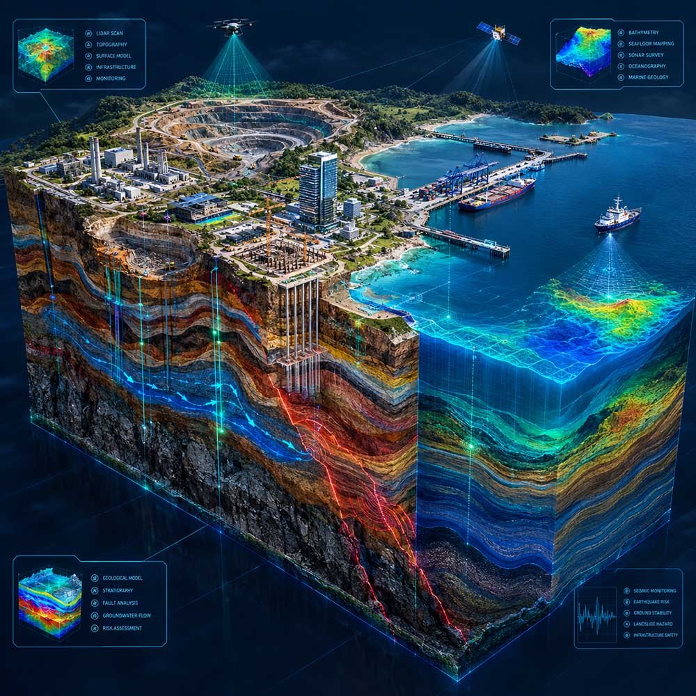
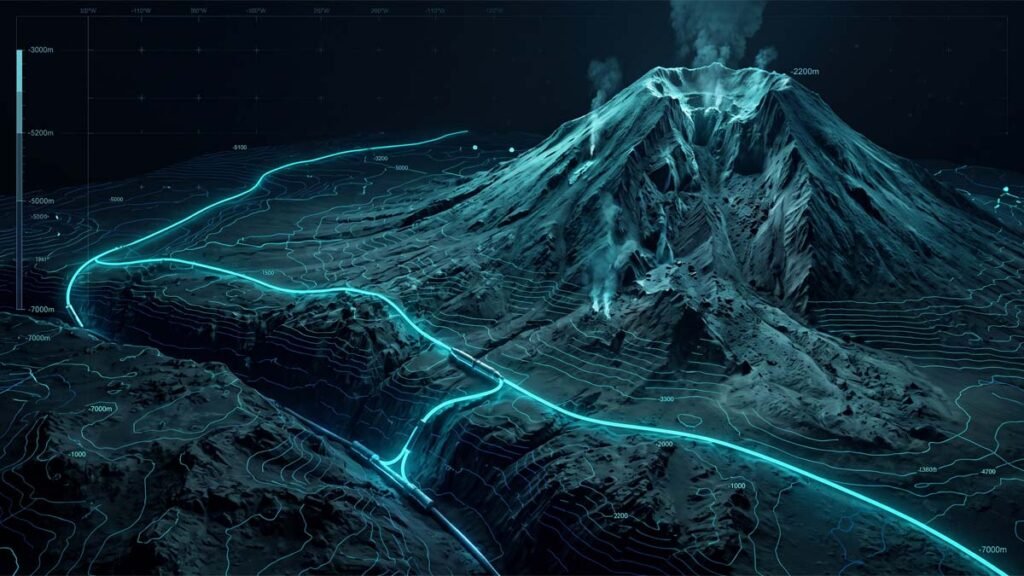
Comprehensive Subsurface Geoscience & Infrastructure 3D Model

Select Your Subsurface or Regulatory Exposure:

100% Client Representation

Zero equipment rental bias. We act strictly as the project owner's representative, ensuring ground investigations and engineering advice are 100% objective.

Independent Mandate

Contract Cost Protection

Preparing Geotechnical Baseline Reports (GBR) before tender so contractors cannot file unexpected extra cost claims for ground conditions.

Learn About GBR

Statutory Permit Clearances

Securing Indonesian marine spatial permits (PKKPRL), groundwater abstraction licenses (SIPA), and naval hydrographic survey clearances.

Permitting Advice

Site & Field Engineering

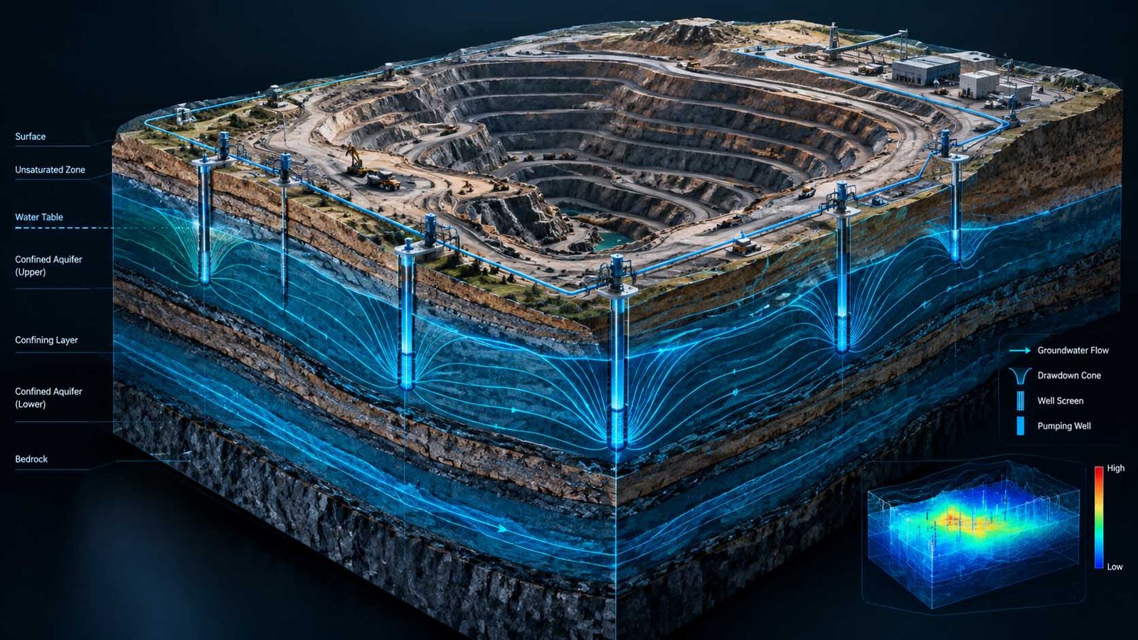
On-site soil boring, drone LiDAR mapping, high-precision bathymetry, and 3D groundwater modeling to deliver construction certainty without rework.

View Methodology
RECOGNIZED TECHNICAL BASELINE

Operating in Strict Accordance with International Standards

Every subsurface investigation, route survey, and geotechnical memorandum is executed under accredited global engineering frameworks and statutory Indonesian maritime clearances.

DNV-ST-0359

Subsea Power Cables

ESCA & ICPC

Subsea Cable Protection Guidelines

IHO S-44

Hydrographic Bathymetry

ISO 19901-8

Marine Soil Investigations

SNI 8460:2017

Foundation Design Standards

PUSHIDROSAL

Naval Hydrography Clearances

KKP • PKKPRL

Marine Spatial Planning (Decree 14/2021)

UI & UNPAK

Academic Research Affiliations
REAL-WORLD INFRASTRUCTURE RISKS • LAND, MINING & MARINE

Hidden Geological & Ground Hazards Threatening Project Budgets

Whether developing high-rise foundations, operating open-pit mines, or laying subsea cables, relying on incomplete geoscience data causes structural failures, permit shutdowns, and huge contractor dispute claims.

Land & Buildings

Cracked Foundations & Soil Settlement

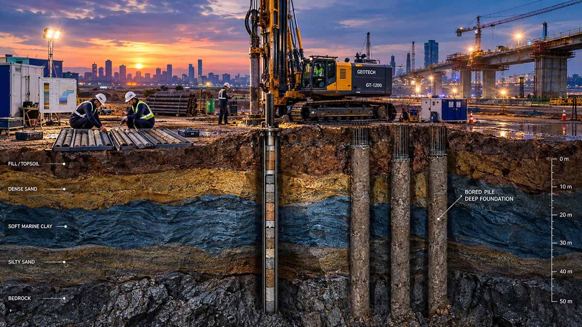
Building on soft clays or unmapped fault lines without deep soil boring leads to structural cracking, uneven building tilt, and expensive underpinning repairs.

  • Differential settlement of soft clay layers tilting high-rise assets
  • Unplanned foundation underpinning inflating construction budgets
GEOPROVE Safeguard:
Deep machine boreholes, SPT/CPTu in-situ testing, and defensible foundation pile capacity calculations.
Coastal & Reclamation

Soil Liquefaction & Flood Surges

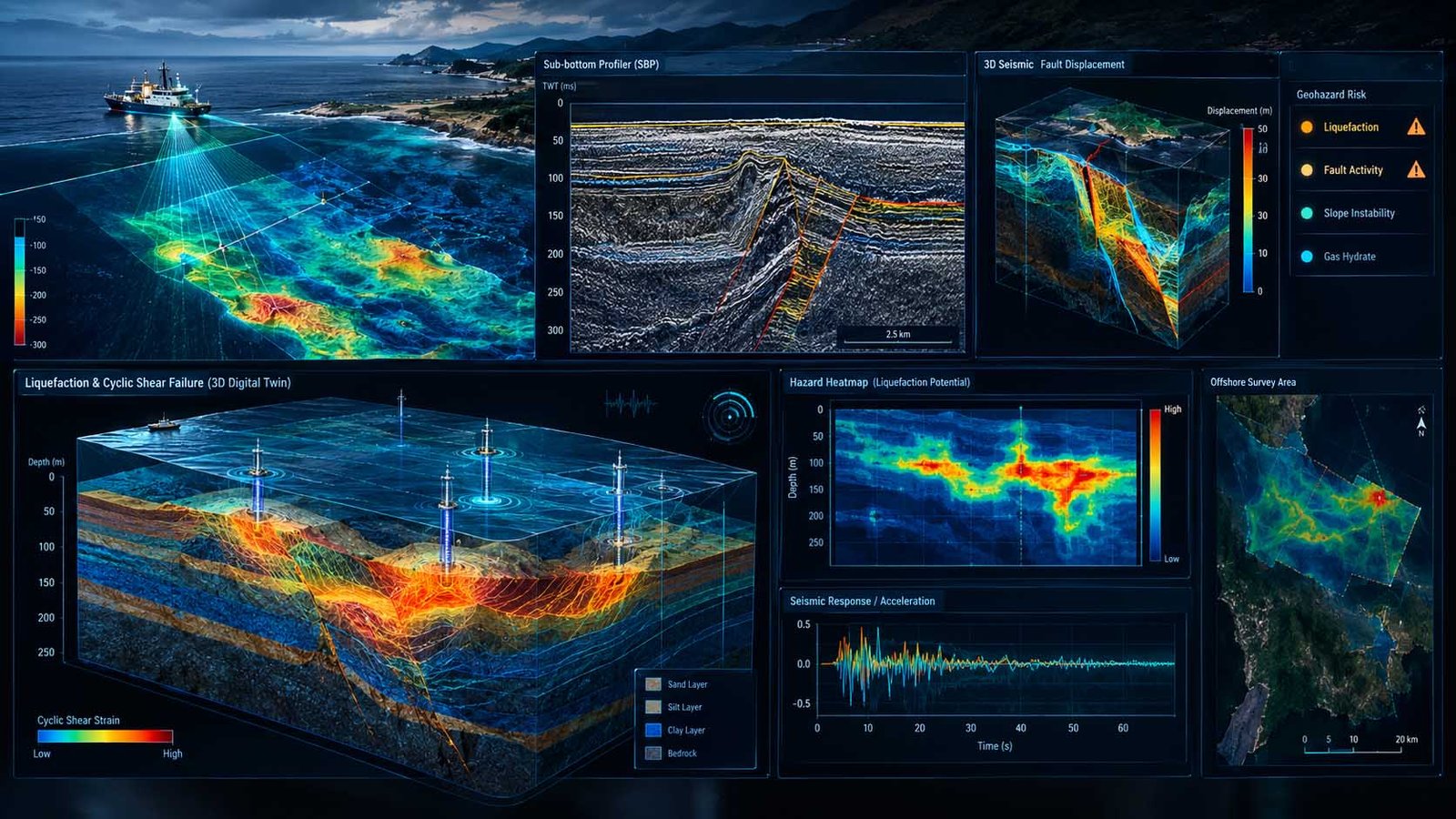
Saturated reclaimed sands liquefy like liquid mud during earthquakes, while tidal floods submerge industrial estates built below high-tide datums.

  • Reclaimed hydraulic sand fill losing bearing capacity during ground motion
  • Extreme coastal flood surges overwhelming low-lying industrial platforms
GEOPROVE Safeguard:
Site-specific PSHA (SNI 1726), empirical liquefaction assessment, and 2D HEC-RAS flood inundation models.
Subsea Corridors

Anchor Snags & Inflated Vessel Day-Rates

Ships drop heavy anchors over unburied cables, while marine contractors demand exorbitant vessel standby rates for "unexpected rocky ground."

  • Anchor dragging and bottom trawling severing shallow-buried power cables
  • Multi-million-dollar contractor standby claims for alleged rocky seabeds
GEOPROVE Safeguard:
Cable Burial Risk Assessment (CBRA DNV-RP-F107), IHO S-44 bathymetry, and sovereign PKKPRL licensing.
Acting as your independent Owner's Engineer, GEOPROVE audits site conditions prior to tender, sets legally binding Geotechnical Baseline Reports (GBR), and secures statutory permits—protecting your capital on land and at sea.
INDEPENDENT OWNER'S ENGINEERING

Engineering Objectivity: Protecting Your Balance Sheet on Land & at Sea.

Civil contractors, drilling vendors, and heavy equipment operators frequently charge massive mobilization fees and inflated standby rates. Without independent engineering verification, project owners routinely pay for oversized foundation piles, redundant soil boreholes, and excessive excavation depths.

GEOPROVE protects your capital across highways, industrial facilities, mining pits, and subsea routes. We audit contractor proposals, verify soil investigation baselines before tender, and ensure you only mobilize what the site conditions genuinely require.

Explore Owner's Engineer Role
Methodology Overview
REAL CAPITAL PROTECTION
As your independent Owner's Engineer, our technical advice is 100% objective, safeguarding the balance sheets of project developers and lenders.
  • Pre-Tender Contractor Audit: Verifying drilling rig and survey vessel specifications to avoid inflated machinery costs.
  • FIDIC Ground Risk Shield: Formulating Geotechnical Baseline Reports (GBR) to eliminate contractor Differing Site Condition claims.
  • Comprehensive Statutory Clearances: Securing SIPA groundwater permits on land and PKKPRL marine spatial approvals along coastal corridors.
Discuss Your Project Scope
ENGINEERING AUDIT SENSOR // REAL-TIME CALIBRATION
SENSOR STANDBY
0%
CONTRACTUAL INDEPENDENCE
0+ YRS
COMBINED EXPERT SENIORITY
0 PILLARS
INTEGRATED PRACTICES
0%
CLIENT ADVOCACY OBJECTIVITY
ENGINEERING ADVISORY COUNCIL

Led by Senior Engineering Faculty & Proven Geoscience Practitioners.

We bridge academic research with industrial field execution. Every technical report is backed by verified soil mechanics, peer-reviewed engineering models, and recognized industry standards.
Universitas Indonesia
Academic Geophysics Council
Institut Teknologi Bandung
Academic Ocean Engineering Council
Geology UNPAK
Academic Applied Geology Council
Pushidrosal
Naval Hydrography Protocol
KKP PKKPRL
Marine Spatial Authority (PKKPRL)
DNV IHO S-44
Global Statutory Framework
OUR FEATURED PROJECTS

Selected Case Studies

We have engineered certainty across high-consequence maritime energy corridors and offshore developments across Southeast Asia.

Request Project Due Diligence Showing 10 of 10 Strategic Corridors
TECHNICAL INTELLIGENCE HUB

Authoritative Decision Papers & Engineering Memoranda

Read and update the latest technical research from our advisers. Rigorous peer-reviewed methodologies for capital-intensive marine infrastructure.

EXECUTIVE ADVISORY WHITE PAPER • 2026 EDITION

The 2026 Developer’s Technical Blueprint: Indonesian Marine Spatial (PKKPRL) & Pushidrosal Clearances for Subsea Corridors & Coastal Terminals

A comprehensive 48-page technical and statutory advisory study formulated by senior subsea geoconsultants, marine regulatory advisors, and university researchers. Essential reading for energy developers, cross-border interconnector sponsors, port concessionaires, and EPC consortiums navigating Indonesian territorial waters.

Statutory PKKPRL & Pushidrosal Roadmap: Step-by-step navigation of Ministerial Decree (Kepmen-KP 14/2021), naval hydrographic clearance, and spatial corridor approvals.
CBRA Trenching & Burial Depth Matrix: Empirical penetration modeling for dynamic straits, anchor drag mitigation, and DNV-ST-0359 compliant protection depths.
FIDIC Emerald Book Ground-Risk Shield: Contractual allocation frameworks to shield developer balance sheets from unforeseen contractor seabed claims.
48 Pages (Executive PDF)
14 Technical Diagrams
GIS Permitting Flowcharts
Fiduciary Non-Disclosure
GEOPROVE.
TECHNICAL ADVISORY MEMORANDUM
INDONESIAN MARINE SPATIAL (PKKPRL) & PUSHIDROSAL BLUEPRINT
2026 EDITION DNV • FIDIC
CONFIDENTIAL

Instant Document Access

Download the unrestricted PDF copy directly to your corporate inbox.

Strict fiduciary confidentiality. Corporate email verification applied. No public distribution.
TECHNICAL ENGAGEMENT & JURISDICTIONAL ADVISORY

Initiate a Technical Due Diligence Consultation

Engage our senior advisory team to evaluate subsurface uncertainties, procurement scopes, or statutory hurdles before mobilizing field assets across Singapore and Indonesian territorial waters.

Project Pre-Scoping Form

Confidential Corridor Scoping

Submit preliminary project coordinates and inquiry scopes. All data is processed under strict fiduciary non-disclosure.

🇮🇩

Indonesia Operational Headquarters

Commercial Scoping, Technical Advisory & Statutory Gateway
WIB (UTC+7)

Focus: Multinational Developer Liaison, Subsea Cable Risk (CBRA), Indonesian Regulatory Gateway (PKKPRL & Pushidrosal Clearances), and Field Geotechnical Oversight.

Bogor Utara, Kota Bogor, Jawa Barat 16150, Indonesia
Monday – Friday: 08:30 – 17:30 WIB
Contractual Neutrality Guaranteed

Zero vessel ownership. Zero contractor day-rate bias. 100% fiduciary technical advocacy dedicated strictly to asset owners and institutional lenders.